Wing, body
and control surfaces.
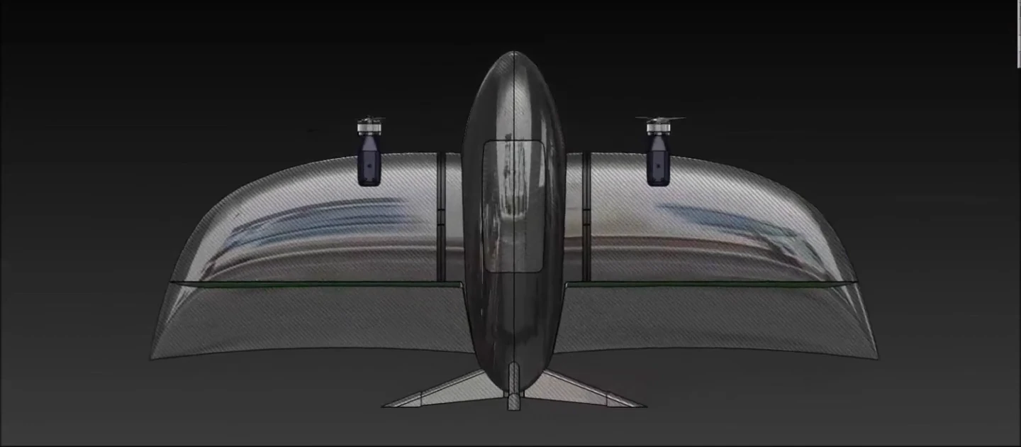
A custom wing and central body, with control surfaces integrated into the airframe. Developed through CAD, analysis and physical iteration.
THE AIRCRAFT
A twin-electric tailsitter combining vertical takeoff and fixed-wing flight. The foundation of our surveying and mapping platform in development.
01AIRCRAFT SPECIFICATIONS
Surveying, commercial agricultural mapping and surveillance. RGB and multispectral payload options for different mission requirements.
Beyond visual line of sight (BVLOS)
Flight time
Operating speed
Auto landing
61 MP full-frame · Integration subject to validation
Commercial agriculture & survey applications
02THE ARCHITECTURE
No separate lift system. No rotating motor nacelles. A tailsitter uses the same propulsion across both flight regimes.
A custom wing and central body, with control surfaces integrated into the airframe. Developed through CAD, analysis and physical iteration.
Two electric motors provide propulsion during vertical and forward flight. Their relationship to the wing is central to the configuration.
The original aircraft was developed around PX4. Flight testing connects the mechanical system with the actual control behaviour.
03THE FLIGHT ENVELOPE
The aircraft starts on its tail and lifts vertically. The same twin-motor airframe will carry it into forward flight.
PROTOTYPE FLIGHT TEST · ORIGINAL SPEEDFROM PROTOTYPE TO PRODUCT
The prototype demonstrates the architecture in flight. Our next phase is a commercial aircraft for surveying and mapping, with a repeatable airframe, a measured operating envelope and a mission workflow developed with survey operators.
The aircraft specification supports mission planning; payload choice, operating conditions and the survey workflow guide each deployment.
Discuss a surveying pilotSURVEYING & MAPPING
We’re working towards a commercial mapping platform.
Help shape it around your field requirements.